Log in
All resources
Create a design
33,480 Free Images of 1570 Maps
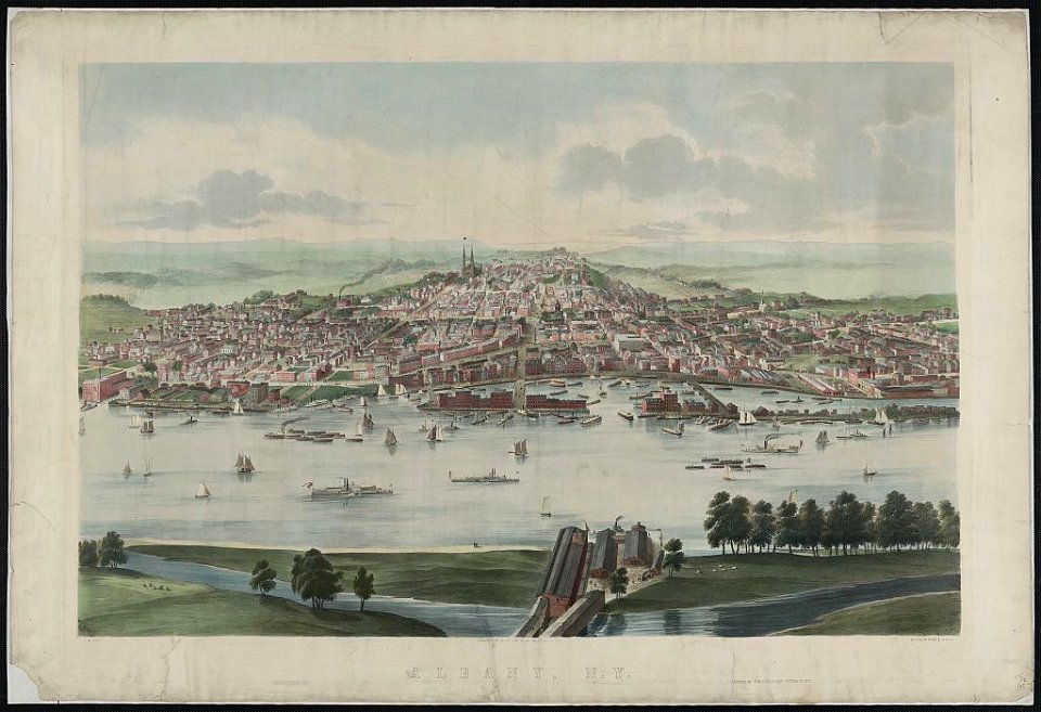
maps in the library of congress
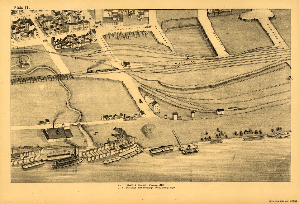
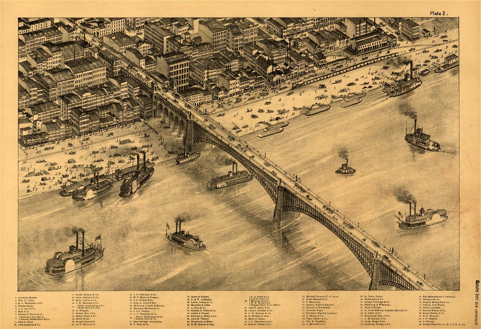
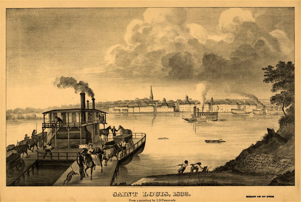
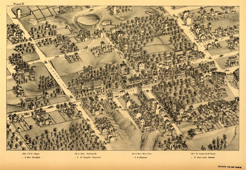
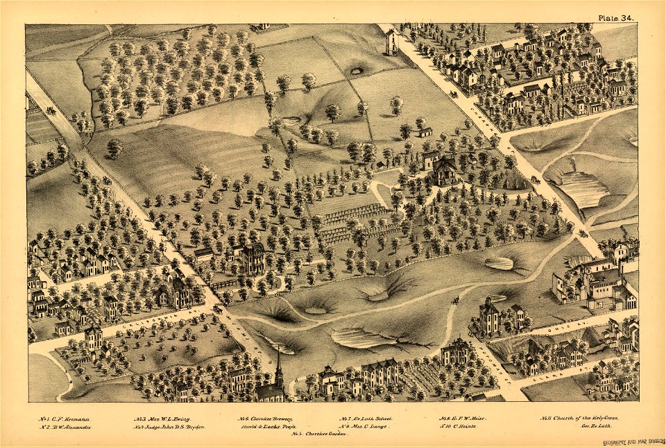
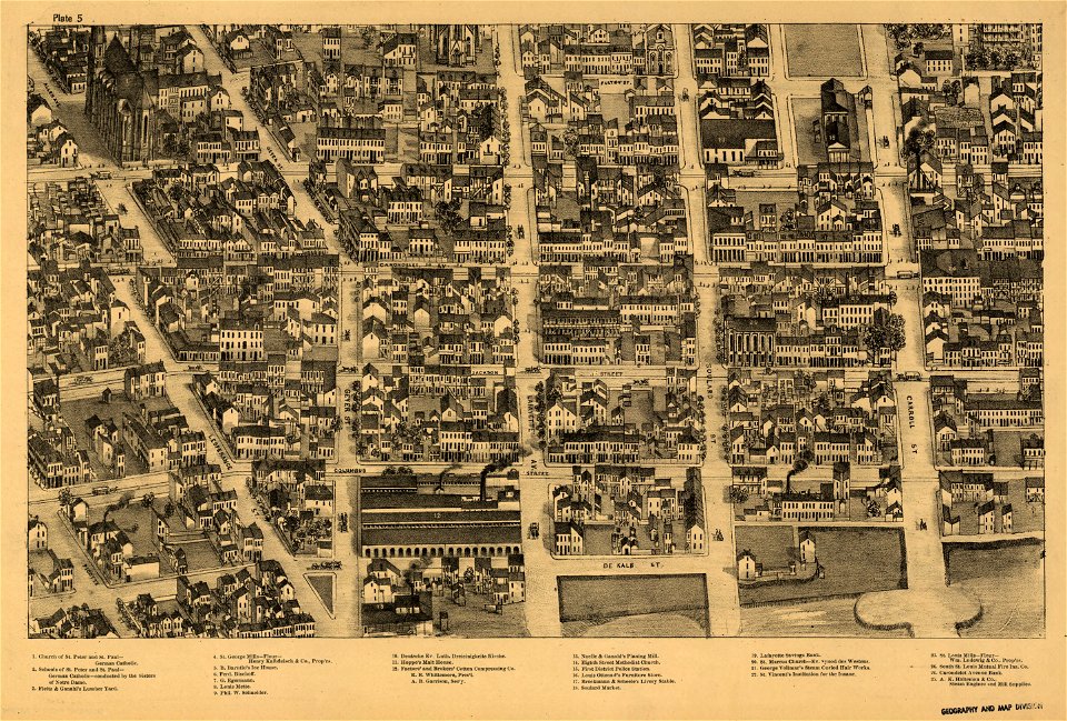
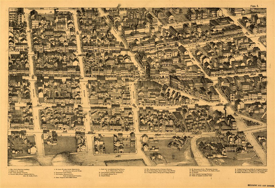
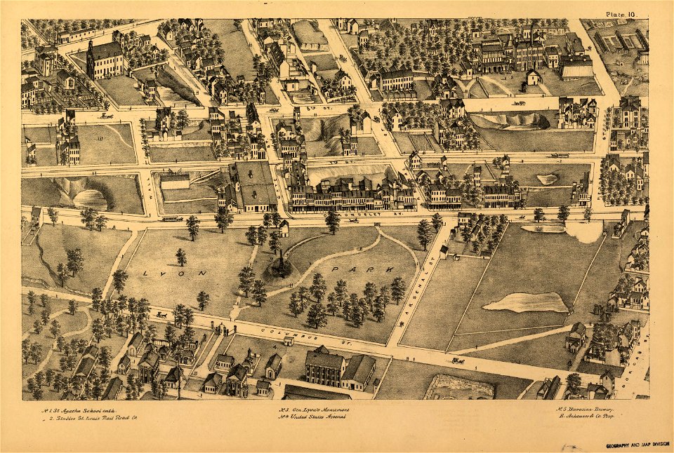
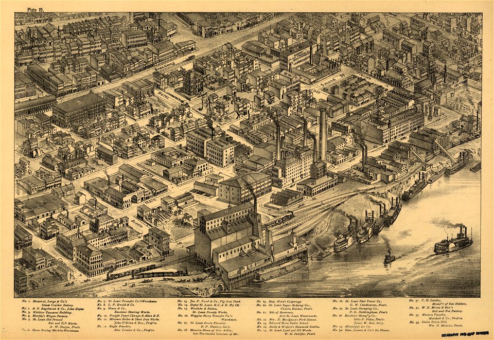
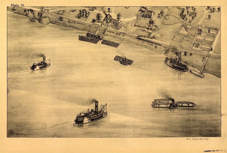
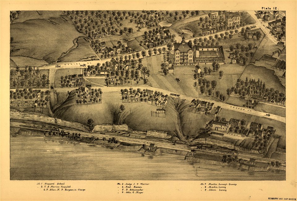
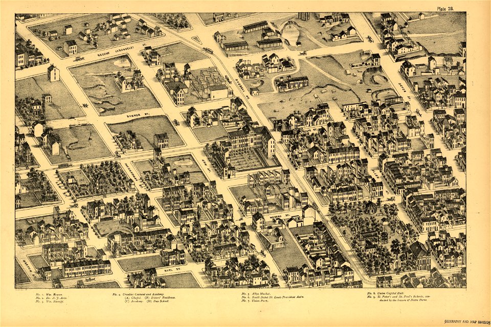
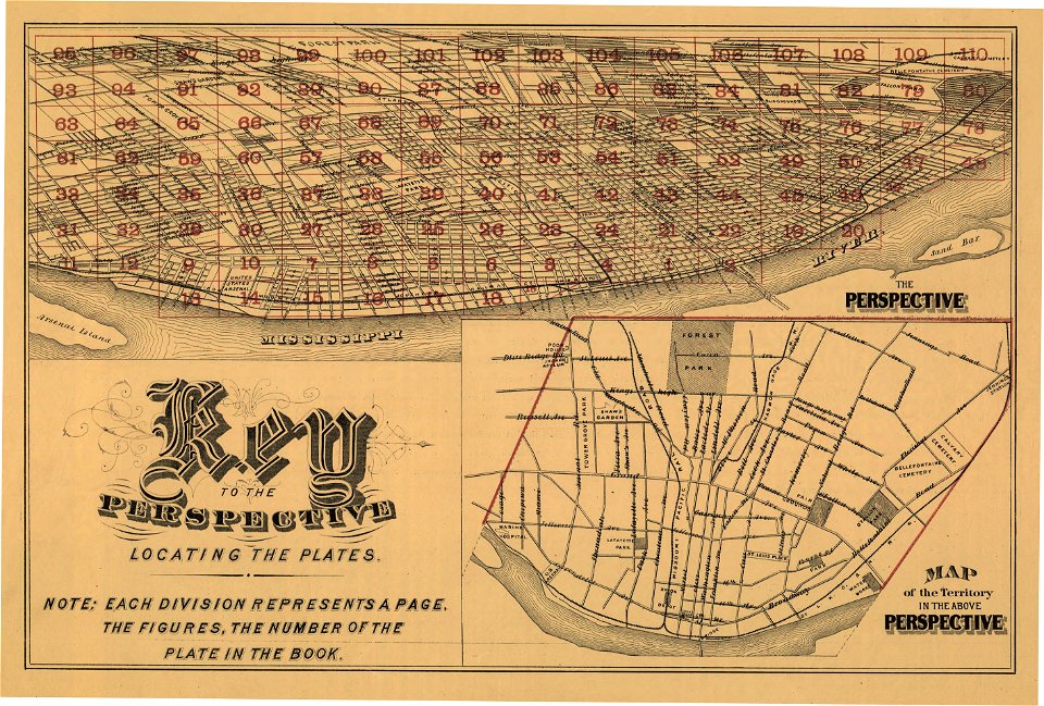
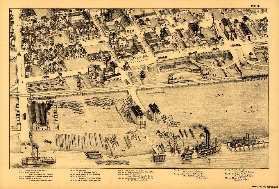
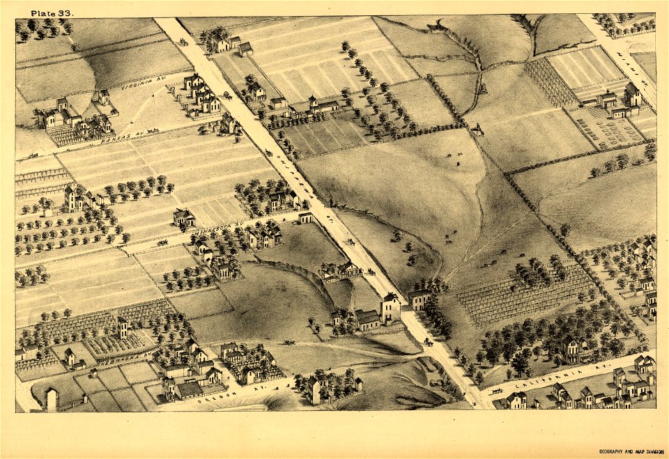
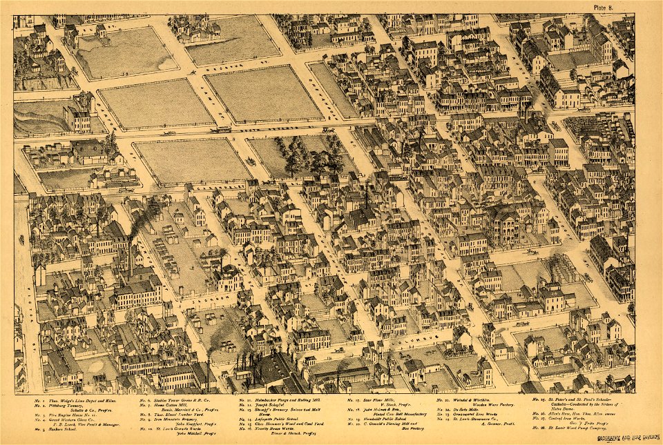
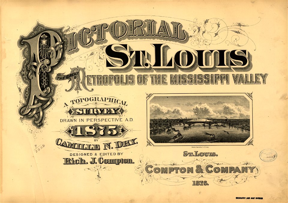
pictorial st. louis
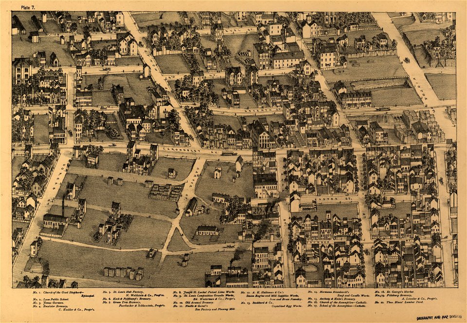
the great metropolis of the mississippi valley; a topographical survey drawn in perspective a.d. 1875
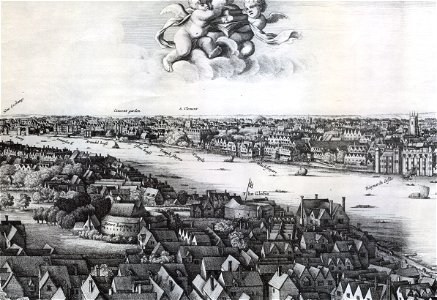
hollar maps and plans of london
drawings and watercolours of the royal museums greenwich
maps and topographical views by joris hoefnagel
university of toronto wenceslas hollar digital collection
serie 5, nederlandse gebeurtenissen, 1566-1570
battle of oosterweel
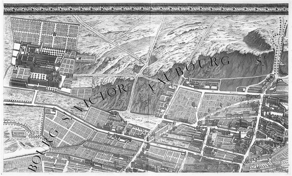
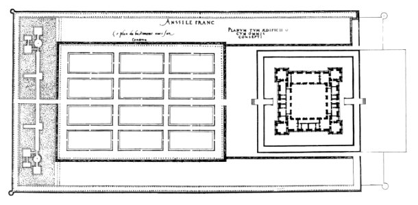
floor plans of paris
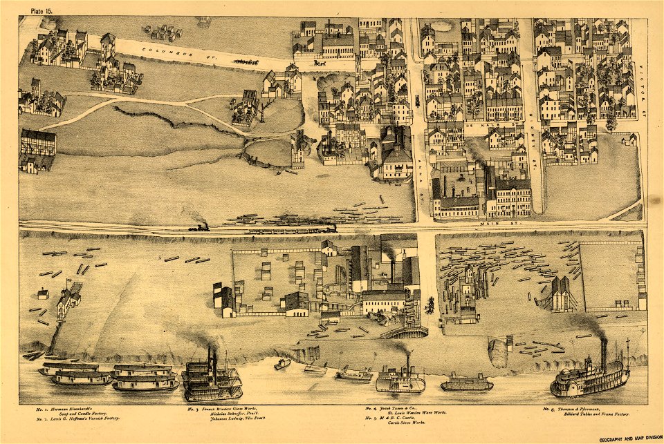
maps in the library of congress
pictorial st. louis
maps in the library of congress
pictorial st. louis
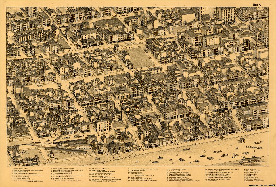
maps in the library of congress
pictorial st. louis
maps in the library of congress
pictorial st. louis
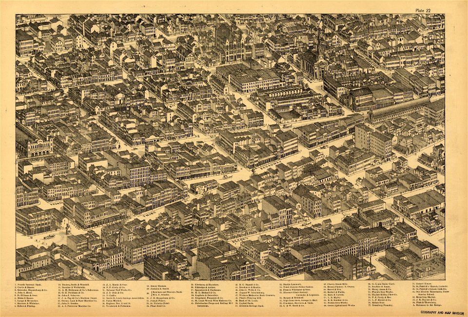
maps in the library of congress
pictorial st. louis
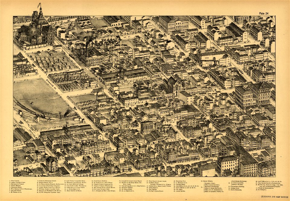
maps in the library of congress
pictorial st. louis
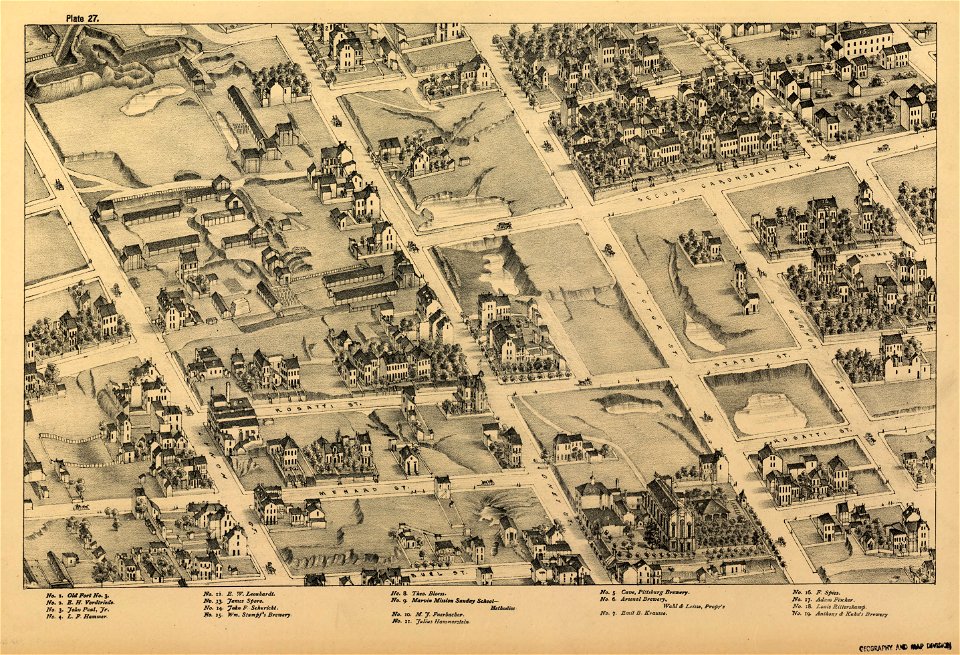
maps in the library of congress
pictorial st. louis
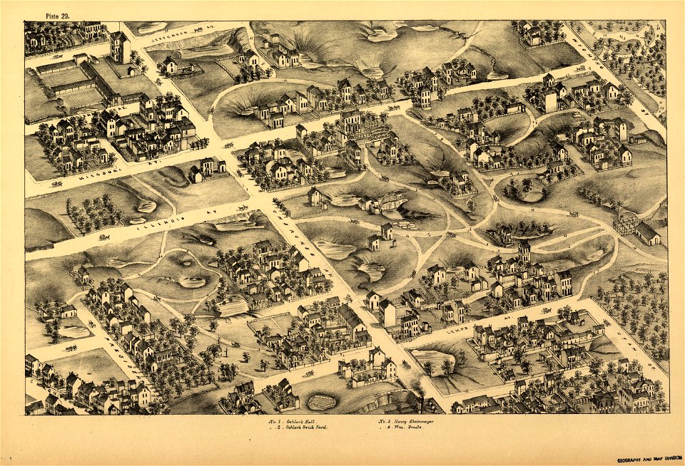
maps in the library of congress
pictorial st. louis
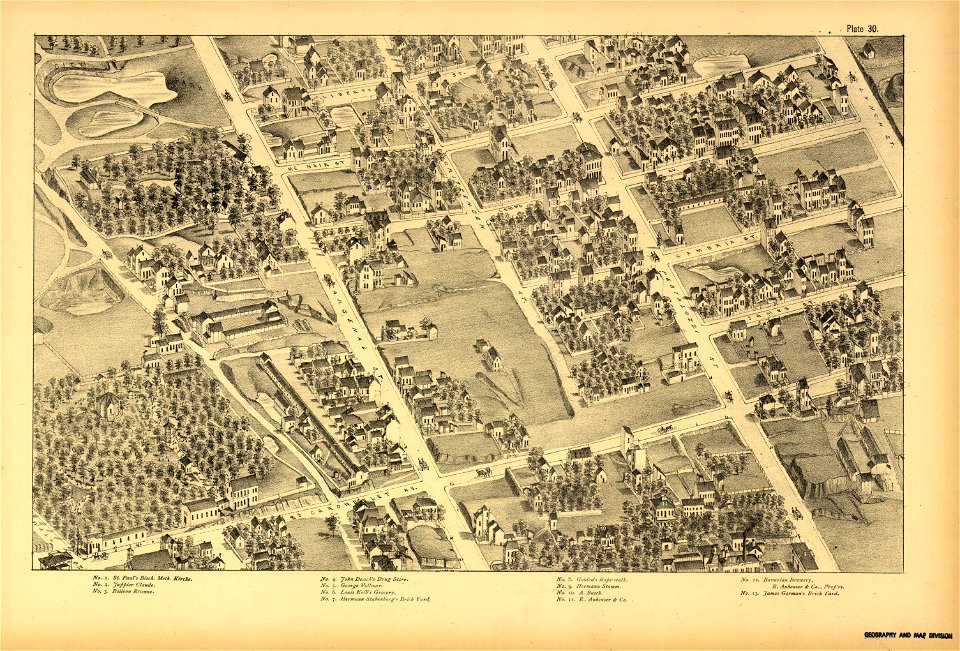
maps in the library of congress
pictorial st. louis
maps in the library of congress
pictorial st. louis
maps in the library of congress
pictorial st. louis
maps in the library of congress
pictorial st. louis
maps in the library of congress
pictorial st. louis
maps in the library of congress
pictorial st. louis
maps in the library of congress
pictorial st. louis
maps in the library of congress
pictorial st. louis
maps in the library of congress
pictorial st. louis
maps in the library of congress
pictorial st. louis
maps in the library of congress
pictorial st. louis
maps in the library of congress
pictorial st. louis
maps in the library of congress
pictorial st. louis
maps in the library of congress
pictorial st. louis
maps in the library of congress
pictorial st. louis
maps in the library of congress
pictorial st. louis
maps in the library of congress
pictorial st. louis
maps in the library of congress
pictorial st. louis
maps in the library of congress
pictorial st. louis
maps in the library of congress
pictorial st. louis
maps in the library of congress
pictorial st. louis
maps in the library of congress
pictorial st. louis
maps in the library of congress
pictorial st. louis
maps in the library of congress
pictorial st. louis
maps in the library of congress
pictorial st. louis
maps in the library of congress
pictorial st. louis
maps in the library of congress
pictorial st. louis
maps in the library of congress
pictorial st. louis
maps in the library of congress
pictorial st. louis
maps in the library of congress
pictorial st. louis
maps in the library of congress
pictorial st. louis
maps in the library of congress
pictorial st. louis
maps in the library of congress
pictorial st. louis
maps in the library of congress
pictorial st. louis
maps in the library of congress
pictorial st. louis
copper engraving
1643 engravings
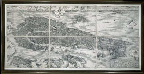
old maps of europe
printing
geographical illustrations by coronelli
3 fleurs-de-lis or in heraldry
ancient kangleipak
high renaissance
père-lachaise cemetery in the 19th century
old maps of the père-lachaise cemetery
serie 5, nederlandse gebeurtenissen, 1566-1570
battle of oosterweel
serie 5, nederlandse gebeurtenissen, 1566-1570
battle of oosterweel
maps from the earth and its inhabitants, vol. vi
exploration of asia
maps by jodocus hondius
old maps of virginia
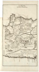
1715 maps of mecklenburg-vorpommern
battles of the great northern war
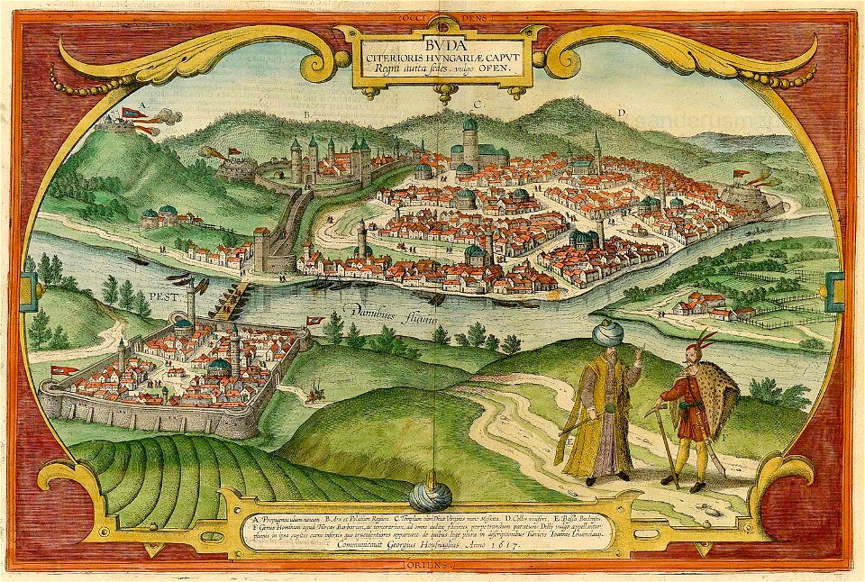
buda castle in art
buda castle
historical images of hôtel de ville de paris
lithographs of paris
cellos in art
artist
maps and topographical views by joris hoefnagel
braun & hogenberg
media contributed by agad presented in former polska.pl portal
old maps of pomerania
old maps of goa
1596
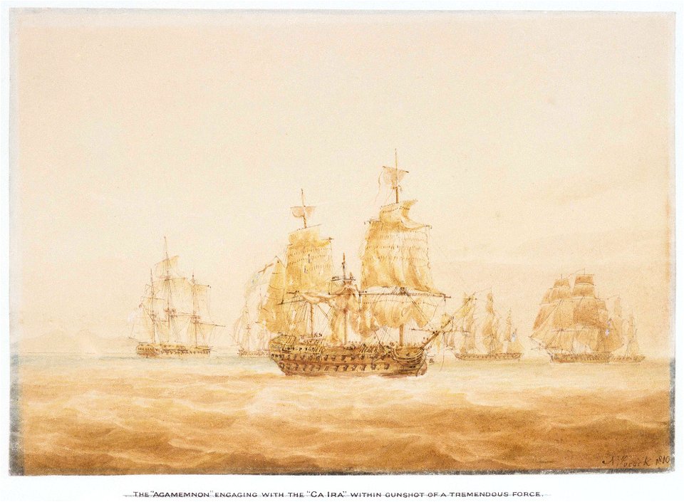
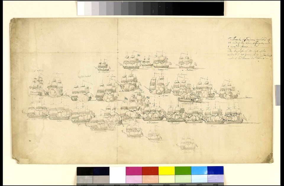
naval battles involving great britain
naval battles involving france
greece
italy
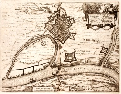
capture of wesel 1629
büderich (wesel)
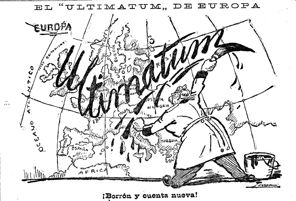
caricatures by manuel tovar in el imparcial
1914
floor plans of paris
engravings of paris
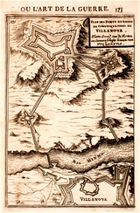
maps of fortifications in portugal
minho river in goián/cerveira
franco-dutch war
netherlands
matthäus merians vogelschauplan von frankfurt am main (1628)
fahrgasse
prints from mémoires des commissaires du roi et de ceux de sa majesté britannique at the peace palace library
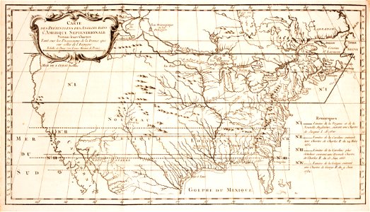
old maps of the united states
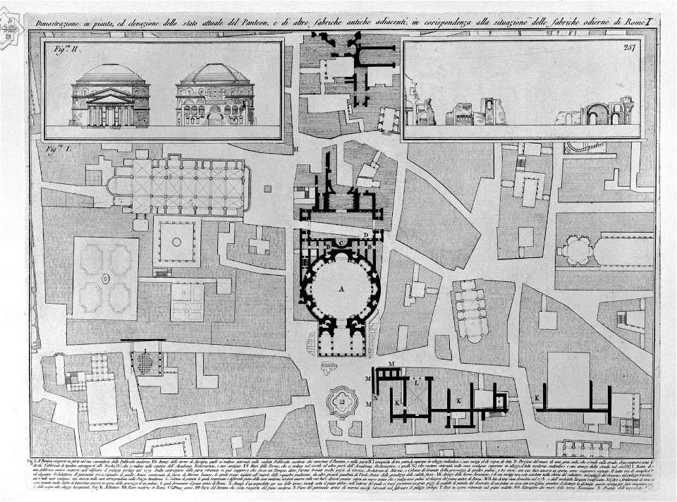
plans of the pantheon (rome)
old maps of rome
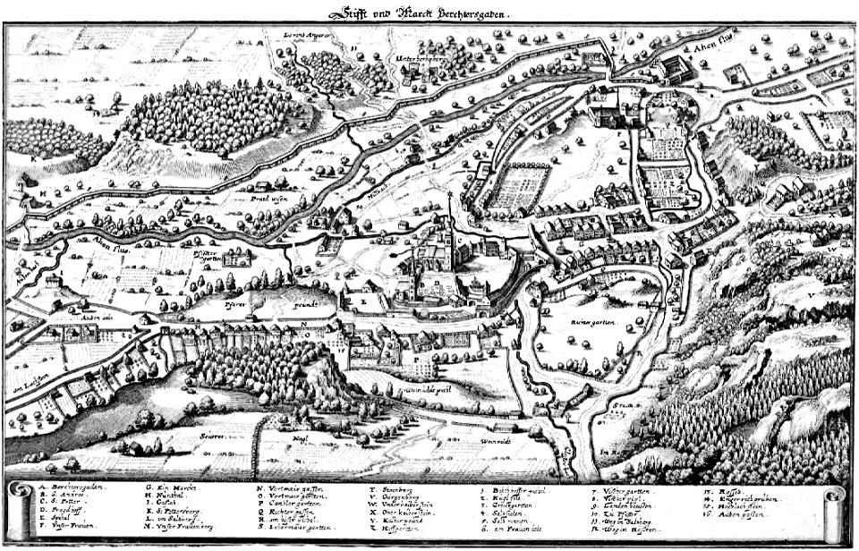
topographie der eydgenoßschaft
1757 in switzerland
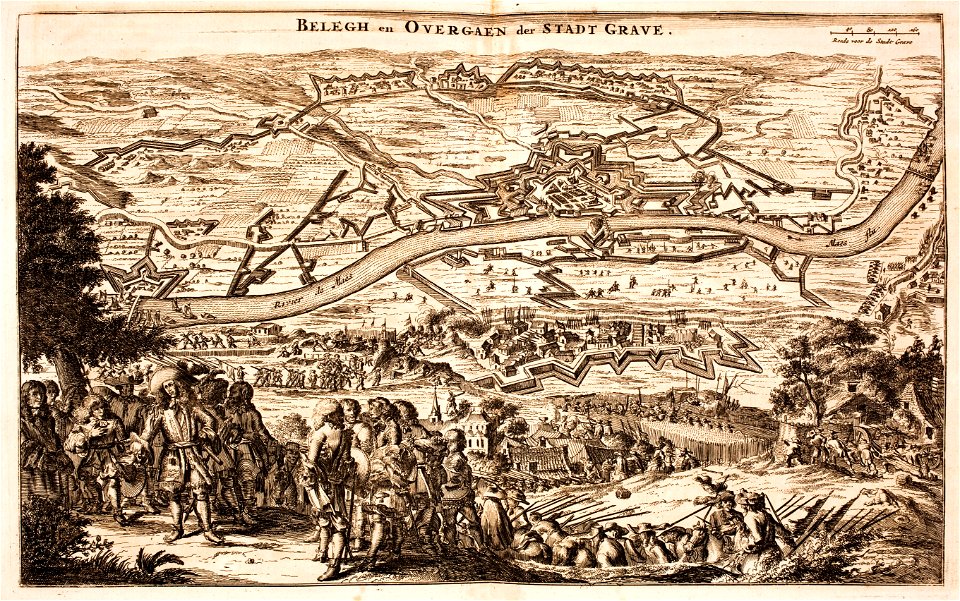
history of rheinberg
history of venlo
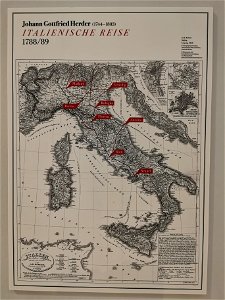
johann gottfried herder
route
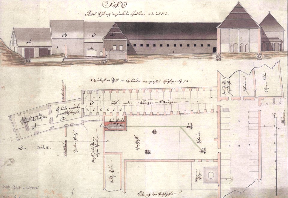
floor plans of buildings in lower saxony
stadtarchiv lüneburg
printing
1781
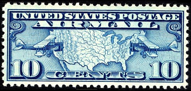
airmail stamps of the united states
blue stamps
kyoto university library
turgot map of paris
1900 maps of russia
1900 maps of china
maps in the library of congress
adriaen van der donck
map postcards
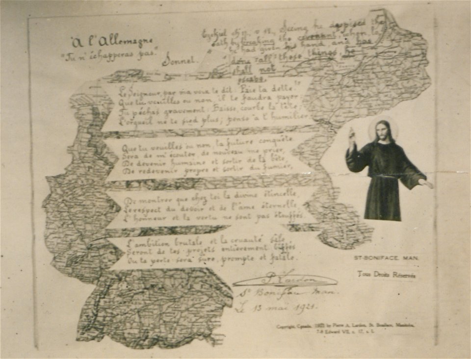
poetry
map postcards
poetry
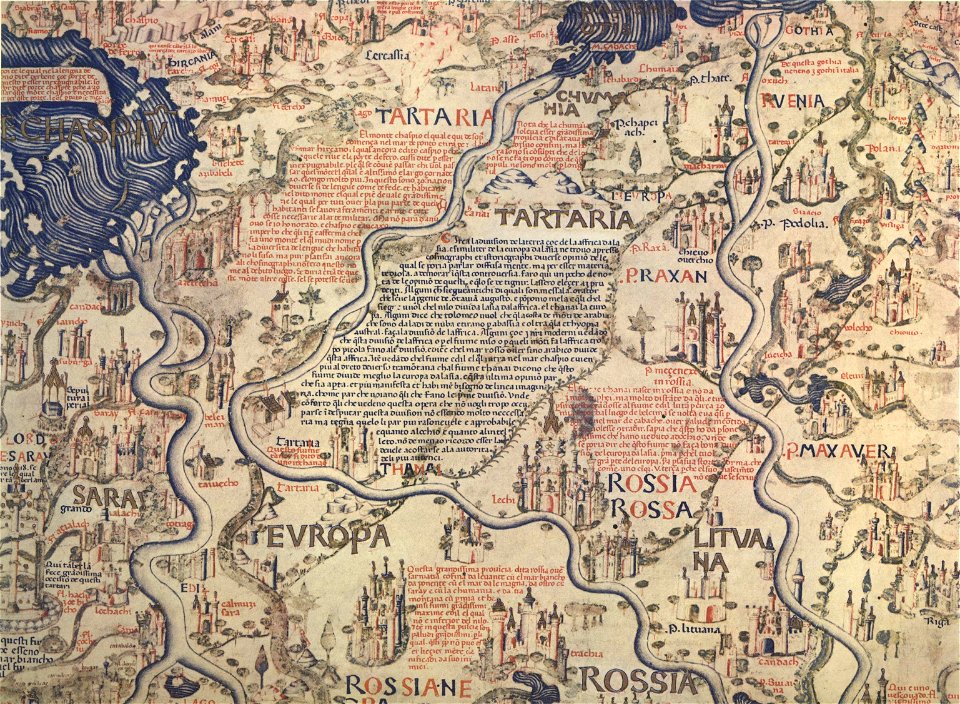
fra mauro map
old maps of svalbard
old maps of iceland
maps in the library of congress
adriaen van der donck
university of toronto wenceslas hollar digital collection
prints by wenzel hollar
architectural prints by wenzel hollar
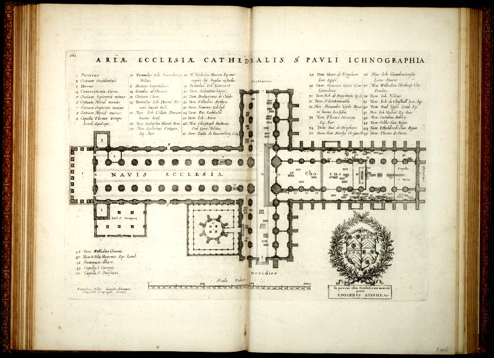
old st paul's cathedral
architectural prints by wenzel hollar
london
1726
asie
1853 lithographs
new york
woodcuts in the rijksmuseum amsterdam
maps in the rijksmuseum amsterdam
plans of castles in france
maps of baroque gardens
mataram sultanate
rembang regency
landscape art
stuart period
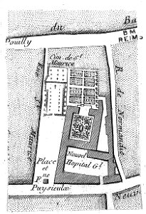
bibliothèque municipale de reims
maps of reims
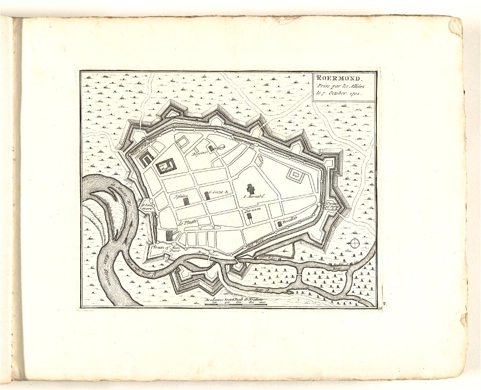
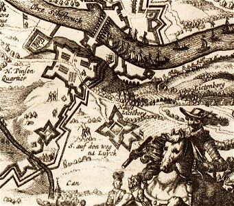
17th-century maps of maastricht
maastricht
regular hexagons
cannons in art
california
san diego
printing
1772
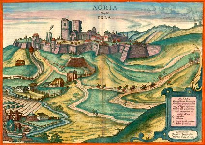
maps and topographical views by joris hoefnagel
hungary
aircraft on stamps of the united states
airmail stamps of the united states
19th-century maps of china
richard jarman
9801 - 9900 of 33,480
Next page
/ 335